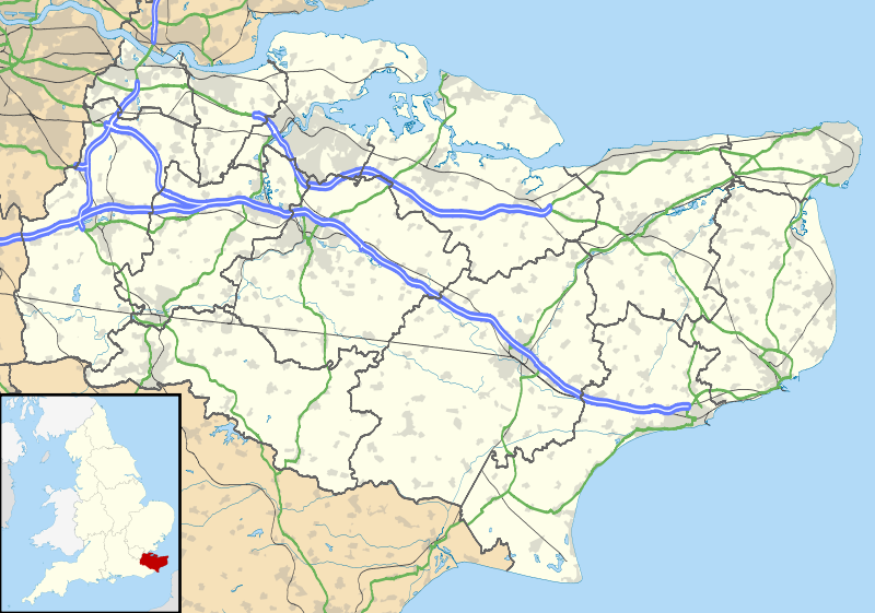
File:Kent UK location map.svg
Appearance

Size of this PNG preview of this SVG file: 800 × 561 pixels. Other resolutions: 320 × 225 pixels | 640 × 449 pixels | 1,024 × 719 pixels | 1,280 × 898 pixels | 2,560 × 1,796 pixels | 1,425 × 1,000 pixels.
Original file (SVG file, nominally 1,425 × 1,000 pixels, file size: 2.11 MB)
File history
Click on a date/time to view the file as it appeared at that time.
| Date/Time | Thumbnail | Dimensions | User | Comment | |
|---|---|---|---|---|---|
| current | 18:58, 26 September 2010 |  | 1,425 × 1,000 (2.11 MB) | Nilfanion | {{Information |Description=Map of Kent, UK with the following information shown: *Administrative borders *Coastline, lakes and rivers *Roads and railways *Urban areas Equirectangular map projection on WGS 84 datum, with N/S stretched 160% Geo |
File usage
More than 100 pages use this file. The following list shows the first 100 pages that use this file only. A full list is available.
- Addington Long Barrow
- Admiralty Pier Turret
- Ashford, Kent
- Aylesford
- Bedgebury National Pinetum
- Broadstairs
- Canterbury
- Charing
- Chatham, Kent
- Chatham Dockyard
- Chestnuts Long Barrow
- Cobham, Kent
- Coffin Stone
- Coldrum Long Barrow
- Dartford Crossing
- Dartford railway station
- Deal, Kent
- Deal Castle
- Dover
- Dover Castle
- Drellingore
- Dungeness
- East Langdon
- Eastry
- Edenbridge, Kent
- Eythorne
- Faversham
- Folkestone
- Fordwich
- Fort Amherst
- Fort Borstal
- Garrison Point Fort
- Gillingham, Kent
- Grain Fort
- Gravesend
- Hadlow
- Hadlow Castle
- Herne Bay
- Hever Castle
- High Halstow
- Higham, Kent
- Hildenborough
- Hoo Peninsula
- Hougham Battery
- Hythe, Kent
- Ightham
- Isle of Grain
- Isle of Sheppey
- Kingsdown, Dover
- Kit's Coty
- Kit's Coty House
- Knole
- Little Kit's Coty House
- Lullingstone Roman Villa
- Lydd
- Maidstone
- Manston Airport
- Margate
- Medway Megaliths
- Minster-in-Thanet
- New Romney
- New Tavern Fort
- Northfleet
- Otford
- Paddock Wood
- Pembury
- Queenborough
- RAF Manston
- Rainham, Kent
- Ramsgate
- Reculver
- Rochester, Kent
- Rochester Cathedral
- Romney Marsh
- Royal Tunbridge Wells
- Sandgate Castle
- Sandwich, Kent
- Sevenoaks
- Sheerness
- Shoreham, Kent
- Shornemead Fort
- Sissinghurst
- Sissinghurst Castle Garden
- Sittingbourne
- Slough Fort
- Smythe's Megalith
- Snodland
- St Nicholas-at-Wade
- Stansted, Kent
- Stone, Kent
- Strood
- Sturry
- Swanscombe
- Tenterden
- Tonbridge
- Walmer
- Walmer Castle
- White Cliffs of Dover
- White Horse Stone
- Whitstable
View more links to this file.
Global file usage
The following other wikis use this file:
- Usage on ar.wikipedia.org
- Usage on bg.wikipedia.org
- Usage on br.wikipedia.org
- Usage on ca.wikipedia.org
- Usage on ceb.wikipedia.org
- Usage on cs.wikipedia.org
- Usage on cy.wikipedia.org
- Usage on el.wikipedia.org
- Usage on es.wikipedia.org
- Canterbury
- Lydd
- Maidstone
- Margate
- Ashford (Kent)
- Eastchurch
- Dartford
- Plantilla:Mapa de localización de Kent
- Addington (Kent)
- Birling
- Borough Green
- Burham
- Ditton
- East Malling and Larkfield
- East Peckham
- Hadlow
- Hildenborough
- Benenden
- Bidborough
- Brenchley
- Kings Hill
- Mereworth
- Leybourne
- Ightham
- Snodland
- Shipbourne
- Wouldham
- Trottiscliffe
- West Malling
- Wateringbury
- Offham
- Platt (Kent)
- West Peckham
- Plaxtol
- Ryarsh
- Capel (Kent)
- Speldhurst
- Hawkhurst
View more global usage of this file.
