Portal:Tropical cyclones
The Tropical Cyclones Portal
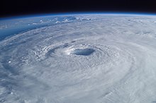
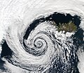
A tropical cyclone is a storm system characterized by a large low-pressure center, a closed low-level circulation and a spiral arrangement of numerous thunderstorms that produce strong winds and heavy rainfall. Tropical cyclones feed on the heat released when moist air rises, resulting in condensation of water vapor contained in the moist air. They are fueled by a different heat mechanism than other cyclonic windstorms such as Nor'easters, European windstorms and polar lows, leading to their classification as "warm core" storm systems. Most tropical cyclones originate in the doldrums, approximately ten degrees from the Equator.
The term "tropical" refers to both the geographic origin of these systems, which form almost exclusively in tropical regions of the globe, as well as to their formation in maritime tropical air masses. The term "cyclone" refers to such storms' cyclonic nature, with anticlockwise rotation in the Northern Hemisphere and clockwise rotation in the Southern Hemisphere. Depending on its location and intensity, a tropical cyclone may be referred to by names such as "hurricane", "typhoon", "tropical storm", "cyclonic storm", "tropical depression" or simply "cyclone".
Types of cyclone: 1. A "Typhoon" is a tropical cyclone located in the North-west Pacific Ocean which has the most cyclonic activity and storms occur year-round. 2. A "Hurricane" is also a tropical cyclone located at the North Atlantic Ocean or North-east Pacific Ocean which have an average storm activity and storms typically form between May 15 and November 30. 3. A "Cyclone" is a tropical cyclone that occurs in the South Pacific and Indian Oceans.
Selected named cyclone -
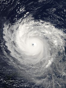
Hurricane Isabel was the strongest Atlantic hurricane since Mitch, and the deadliest, costliest, and most intense hurricane in the 2003 Atlantic hurricane season. Hurricane Isabel was also the strongest hurricane in the open waters of the Atlantic, both by wind speed and central pressure, before being surpassed by hurricanes Irma and Dorian in 2017 and 2019, respectively. The ninth named storm, fifth hurricane, and second major hurricane of the season, Isabel formed near the Cape Verde Islands from a tropical wave on September 6, in the tropical Atlantic Ocean. It moved northwestward, and within an environment of light wind shear and warm waters, it steadily strengthened to reach peak winds of 165 mph (266 km/h) on September 11. After fluctuating in intensity for four days, during which it displayed annular characteristics, Isabel gradually weakened and made landfall on the Outer Banks of North Carolina, with winds of 105 mph (169 km/h) on September 18. Isabel quickly weakened over land and became extratropical over western Pennsylvania on the next day. On September 20, the extratropical remnants of Isabel were absorbed into another system over Eastern Canada.
In North Carolina, the storm surge from Isabel washed out a portion of Hatteras Island to form what was unofficially known as Isabel Inlet. Damage was greatest along the Outer Banks, where thousands of homes were damaged or even destroyed. The worst of the effects of Isabel occurred in Virginia, especially in the Hampton Roads area and along the shores of rivers as far west and north as Richmond and Baltimore. Virginia reported the most deaths and damage from the hurricane. About 64% of the damage and 69% of the deaths occurred in North Carolina and Virginia. Electric service was disrupted in areas of Virginia for several days, some more rural areas were without electricity for weeks, and local flooding caused thousands of dollars in damage. (Full article...)
Selected article -

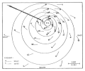
The eye is a region of mostly calm weather at the center of a tropical cyclone. The eye of a storm is a roughly circular area, typically 30–65 kilometers (19–40 miles; 16–35 nautical miles) in diameter. It is surrounded by the eyewall, a ring of towering thunderstorms where the most severe weather and highest winds of the cyclone occur. The cyclone's lowest barometric pressure occurs in the eye and can be as much as 15 percent lower than the pressure outside the storm.
In strong tropical cyclones, the eye is characterized by light winds and clear skies, surrounded on all sides by a towering, symmetric eyewall. In weaker tropical cyclones, the eye is less well defined and can be covered by the central dense overcast, an area of high, thick clouds that show up brightly on satellite imagery. Weaker or disorganized storms may also feature an eyewall that does not completely encircle the eye or have an eye that features heavy rain. In all storms, however, the eye is where the barometer reading is lowest. (Full article...)
Selected image -

Selected season -

The 1998 Atlantic hurricane season was a catastrophic and deadly Atlantic hurricane season, which had the highest number of storm-related fatalities in over 218 years and some of the costliest ever at the time. The season had above average activity, due to the dissipation of an El Niño event and transition to La Niña conditions. It officially began on June 1 and ended on November 30, dates which conventionally delimit the period during which most tropical cyclones form in the Atlantic Ocean. The season had a rather slow start, with no tropical cyclones forming in June. The first tropical cyclone, Tropical Storm Alex, developed on July 27, and the season's final storm, Hurricane Nicole, became extratropical on December 1.
Several storms made landfall or directly affected land. Hurricane Bonnie made landfall in southeastern North Carolina as a Category 2 hurricane in late August, killing five people and causing about $1 billion in damage. Hurricane Earl caused $79 million in damage and three deaths after making landfall in Florida as a Category 1 hurricane. (Full article...)
Related portals
Currently active tropical cyclones

Italicized basins are unofficial.
- North Atlantic (2024)
- No active systems
- East and Central Pacific (2024)
- No active systems
- West Pacific (2024)
- No active systems
- North Indian Ocean (2024)
- No active systems
- Mediterranean (2024–25)
- No active systems
- Australian region (2024–25)
- No active systems
- South Pacific (2024–25)
- No active systems
- South Atlantic (2024–25)
- No active systems
Last updated: 21:47, 14 December 2024 (UTC)
Tropical cyclone anniversaries

December 17
- 1944 - Typhoon Cobra hit the United States Navy Fast Carrier Task Force east of Luzon in the Philippine Sea. The storm sank three destroyers and killed 790 sailors.
- 2020 - Cyclone Yasa (pictured) makes landfall over Fiji, killing 4 people. It holds the fourth most intense tropical cyclone in the South Pacific basin, with a minimum barometric pressure of 899 hPa (26.55 inHg).

December 18
- 1959 - Typhoon Gilda made landfall on the eastern Philippine coast, killing 23 people and rendering 230,000 others homeless.
- 2010 - A kona storm develops near the International Dateline, which subsequently developed into Tropical Storm Omeka (pictured).

December 19
- 1990 - Typhoon Russ (pictured) reached its peak intensity with a central pressure of 915 hPa (mbar) to the southeast of Guam.
- 2020 - Tropical Storm Krovanh emerges to the South China Sea after affecting central Philippines, which brought flooding that resulted in 9 fatalities and damages of ₱213.2 million (US$4.48 million).
Did you know…


- …that the Joint Typhoon Warning Center considers that Typhoon Vera (pictured) of 1986 is actually two distinct systems, formed from two separated low-level circulations?
- …that Cyclone Freddy (track pictured) in 2023 was the longest-lasting tropical cyclone recorded?
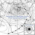
- …that the typhoons of 2024—Yinxing, Toraji, Usagi, and Man-yi (pictured)—made history as the first recorded instance since 1951 of four tropical cyclones coexisting in November?
- …that Hurricane Otis (pictured) in 2023 was the first Pacific hurricane to make landfall at Category 5 intensity and surpassed Hurricane Patricia as the strongest landfalling Pacific hurricane on record?
General images -

The list of North Carolina hurricanes from 1980 to 1999 encompasses approximately 68 tropical or subtropical cyclones that affected the US state of North Carolina. Collectively, cyclones in North Carolina during the time period resulted in around $10 billion in damage (2007 USD), primarily from hurricanes Fran and Floyd. Additionally, tropical cyclones in North Carolina were responsible for about 56 direct fatalities and at least 47 indirect casualties during the period. Eight cyclones affected the state in the 1985 season, which was the year with the most tropical cyclones impacting the state. Every year included at least one tropical cyclone affecting the state. All but two storms were North Atlantic hurricanes; the exceptions were Eastern Pacific hurricanes Tico in 1983 and Roslyn in 1986.
The strongest hurricane to hit the state during the time period was Hurricane Fran in 1996, which struck near Wilmington as a Category 3 hurricane on the Saffir–Simpson hurricane scale; Hurricane Emily in 1993 brushed the Outer Banks also as a Category 3 hurricane. The deadliest hurricane during the period was Hurricane Floyd in 1999, which caused 35 fatalities and record-breaking flooding in the eastern portion of the state. Cyclones affected the state in each month of the hurricane season from June to November, primarily in September. (Full article...)
Topics
Subcategories
Related WikiProjects
WikiProject Tropical cyclones is the central point of coordination for Wikipedia's coverage of tropical cyclones. Feel free to help!
WikiProject Weather is the main center point of coordination for Wikipedia's coverage of meteorology in general, and the parent project of WikiProject Tropical cyclones. Three other branches of WikiProject Weather in particular share significant overlaps with WikiProject Tropical cyclones:
- The Non-tropical storms task force coordinates most of Wikipedia's coverage on extratropical cyclones, which tropical cyclones often transition into near the end of their lifespan.
- The Floods task force takes on the scope of flooding events all over the world, with rainfall from tropical cyclones a significant factor in many of them.
- WikiProject Severe weather documents the effects of extreme weather such as tornadoes, which landfalling tropical cyclones can produce.
Things you can do
 |
Here are some tasks awaiting attention:
|
Wikimedia
The following Wikimedia Foundation sister projects provide more on this subject:
-
Commons
Free media repository -
Wikibooks
Free textbooks and manuals -
Wikidata
Free knowledge base -
Wikinews
Free-content news -
Wikiquote
Collection of quotations -
Wikisource
Free-content library -
Wikiversity
Free learning tools -
Wikivoyage
Free travel guide -
Wiktionary
Dictionary and thesaurus

